Mapping Human Rights Abuses
Download the 2025 Issue Brief
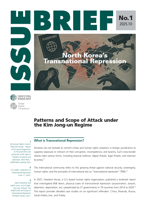
English: https://en.tjwg.org/wp-content/uploads/2025/11/TNR-IB-No.1-Final-EN-issn.pdf
한국어: https://en.tjwg.org/wp-content/uploads/2025/11/TNR-IB-No.1-Final-KR-issn.pdf
This project was launched in 2024 by the Transitional Justice Working Group (TJWG), a Seoul-based human rights documentation and advocacy NGO, and Global Rights Compliance (GRC), an international law foundation dedicated to promoting accountability through the innovative application of international law.
The project aims to investigate the continuity, geographic scope, victim groups, and the changing means and attack patterns of North Korea’s transnational repression. With the broader objective of seeking countermeasures against the crime, we will continue to collect information about suspected cases of transnational repression and identify incidents that have detailed information. The project will also determine elements of transnational repression and analyze North Korea’s operational methods. Researchers and external subject-matter consultants outside the portfolio of the project’s main partners have also been brought onto the project to investigate the role of involved countries other than North Korea and compile and analyze information in various languages. In 2026, TJWG and GRC will publish and distribute a comprehensive report in English and Korean.
Download the 2025 Report
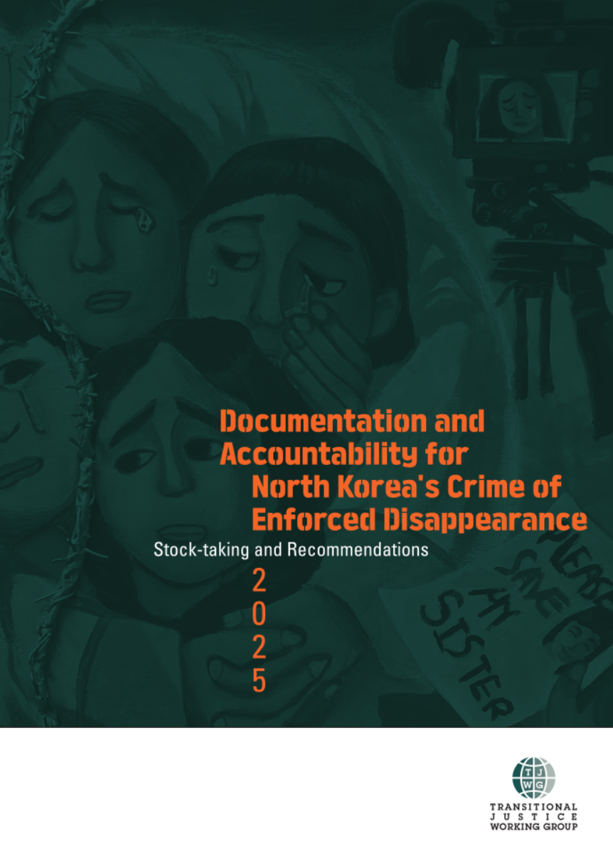
한국어: https://en.tjwg.org/wp-content/uploads/2025/07/보고서2025_북한-강제실종범죄의-조사기록과-책임규명.pdf
The Transitional Justice Working Group has undertaken a comprehensive research effort to document the crime of enforced disappearance in its 2024 publication, Existing “Nowhere”: Looking into North Korea’s Crime of Enforced Disappearance. This new report, Documentation and Accountability for North Korea’s Crime of Enforced Disappearance: Stock-taking and Recommendations, builds on prior findings, presenting recommendations based on the stock-taking of the advocacy efforts and milestones made thus far by victim families and human rights organizations to combat North Korea’s crime of enforced disappearance and presents recommendations for actions key stakeholders should take to overcome the bureaucratic and political inertia and inaction that impedes progress in promoting documentation and accountability.
The report highlights that the crime of enforced disappearance often begins outside of North Korea’s borders. Russia and China maintain close cooperation with the North Korean state to monitor North Korean refugees and forcibly repatriate them back to North Korean soil. TJWG urges China and Russia to stop the complicity and end the forcible repatriation of North Korean refugees and escapees in violation of the principle of non-refoulement.
The report also stresses the importance of naming individuals and institutions responsible for disappearances and using this information to support future prosecutions and targeted sanctions. Without clear public action from the international community, the North Korean regime does not have any incentive to put a stop to the crime of enforced disappearances. Countries with Magnitsky-targeted sanctions framework should implement sanctions against individuals and entities most responsible for North Korea’s enforced disappearance and other grave human rights violations. Countries without such targeted sanctions laws should establish them to participate in international cooperation, as well as provide support to human rights organizations that are trying to provide the necessary information. TJWG will also continue to compile profiles of perpetrators, including high-ranking officials in the MSS and other state organs.
[Press Release] Documentation and Accountability for North Korea’s Crime of Enforced Disappearance
[보도자료] 북한 강제실종범죄의 조사기록과 책임규명_이행 점검과 권고사항
[新聞稿] 北韓強迫失蹤罪行記錄與究責
[新闻稿] 朝鲜强迫失踪罪行记录与究责
Download the 2024 Report
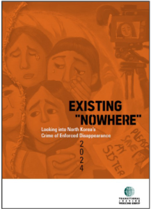 English:
 한국어: https://en.tjwg.org/wp-content/uploads/2024/10/보고서2024_존재할-수-없는-존재_북한-강제실종범죄-조사-2024-10-31.pdf
The Transitional Justice Working Group (TJWG)’s report Existing “Nowhere”: Looking into North Korea’s Crime of Enforced Disappearance is based on four years of research (2020-2024) to document the crime of enforced disappearance committed by the Democratic People’s Republic of Korea (North Korea).
From January 2021 to May 2024, TJWG conducted in-depth interviews with 62 North Korean escapees in South Korea. Through the interviews, TJWG collected detailed information on 66 cases of 113 victims of enforced disappearance. TJWG’s findings show that the Ministry of State Security (국가보위성 / gukgabowiseong / MSS) is responsible for 81.4% of enforced disappearances after arrest, detention and repatriation.
The report also highlights cases of enforced disappearance through various illustrations such as maps depicting transfer routes of North Korean escapees after repatriation. The process of enforced disappearance is depicted taking the case of a North Korean resident who was preparing to escape from North Korea. The scope of enforced disappearance is demonstrated in a family tree that shows an entire family, including the victim’s children and their spouses, who all went missing.
Enforced disappearances committed by the North Korean regime against its residents have been widely overlooked, creating an imbalance between low awareness of the issue and high severity of the matter. Our interviewees hope for a world in which people understand the suffering of those who were forcibly disappeared and the impotence experienced by their families and friends. They aspire for more people to join and collectively urge governments to take action.
Press Release: [Press Release]Existing Nowhere Looking into North Koreas Crimes of Enforced Disappearance
Download the 2023 Report
 English:
 한국어: https://en.tjwg.org/wp-content/uploads/2023/02/보고서2023_북한풍계리핵실험장방사성물질의지하수오염위험과영향매핑.pdf
中國語: https://en.tjwg.org/wp-content/uploads/2024/04/朝鲜丰溪里核试验场放射性物质对地下水的污染风险与影响制图.pdf
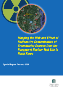
In the new report “Mapping the Risk and Effect of Radioactive Contamination of Groundwater Sources from the Punggye-ri Nuclear Test Site in North Korea”, Transitional Justice Working Group (TJWG) presents the first comprehensive overview of risk from the leakage and dissemination by water of the radioactive materials from the nuclear test site. TJWG mapped the possible dissemination of radioactive materials to the hundreds of thousands of North Koreans living in the vicinity of Punggye-ri and explored the ways in which smuggling and distribution of the agricultural and marine products as well as local specialties like pine mushrooms from the area may leave not only the North Korean people but also the population in neighboring China, South Korea and Japan at risk.
The report also highlights the failure of the key stakeholders, in particular the South Korean government, to address this risk properly and urges internationally the resumption of radiation exposure tests for all North Korean escapees from the areas near Punggye-ri in South Korea who desire them and the disclosure of the test results; the strengthening of inspection of agricultural and marine products from North Korea and international coordination; a prompt, effective, thorough, independent and impartial investigation into the risk of groundwater contamination from the radioactive materials, the prevention of harm and remedies.
Download the 2021 Report
 English: https://en.tjwg.org/wp-content/uploads/2021/12/Report2021_MappingKillingsUnderKimJong-un.pdf
한국어: https://en.tjwg.org/wp-content/uploads/2022/02/보고서2021_김정은시기의처형매핑.pdf
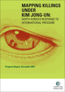
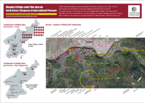
December 17, 2021 marks ten years of Kim Jong-un rule. The Seoul-based Transitional Justice Working Group (TJWG) analyses satellite imagery and interviews with North Korean escapees to examine how state killing practices have shifted in the Democratic People’s Republic of Korea (North Korea) under the young leader. North Korea, in response to international criticism, has changed its killing practices, clamping down on potential information leakages by selecting execution sites that are easier to control. The report presents in-depth analysis of identified killing sites in Hyesan City before and after Kim Jong-un took power.
The new report, “Mapping Killings under Kim Jong-un: North Korea’s Response to International Pressure,” is based on 6 years of research and 683 escapee interviews documenting and mapping three types of locations connected to human rights violations:
- State-sanctioned killing sites;
- Sites where the dead are disposed of by the state;
- Official locations which may contain documents or other evidence related to these events.
Geographical mapping of sites connected to human rights abuses provides important information that are often not visible in individual interviewee testimonies. The project uses satellite imagery during interviews with North Korean escapees to geolocate sites and applies Geographic Information Systems (GIS) technology throughout the research process.
Press Release: [Press Release] TJWG Mapping Killings Under Kim Jong-un
For a visual overview of the report’s key findings, download the infographic below.
English: [Infographics] Mapping Killings Under Kim Jong-un
Korean: 인포그래픽_김정은_시기의_처형_국제적_압력에_대한_북한의_반응
Español: [Infografías] Una Cartografia De Los Asesinatos Durante El Regimen De Kim Jong-Un
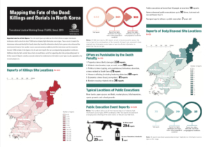
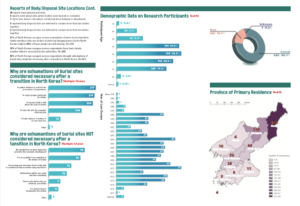
Download the 2019 Report
 English: [2019 Report] Mapping the Fate of the Dead
Korean: [2019 보고서] 살해 당한 사람들을 위한 매핑
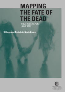
The Transitional Justice Working Group’s 2019 report “Mapping the Fate of the
Dead: Killings and Burials in North Korea” is based on four years of research
(2015-2019) to document and map three types of locations connected to human rights
violations in the Democratic People’s Republic of Korea (North Korea):
1. State-sanctioned killing sites;
2. Sites where the dead are disposed of by the state;
3. Official locations which may contain documents or other evidence related to these events.
The project uses satellite imagery during interviews with North Korean escapees to geolocate these sites and applies Geographic Information Systems (GIS) technology throughout the research process.
Geographical mapping of sites connected to human rights abuses provides important information about patterns of killing and burial that are often not visible in individual interviewee testimonies.
Download the mapping datasets in .kml and .geojson format: https://drive.google.com/open?id=18Wvcuj_X3dXQdXZnc1a8U8tijsEIqrea
These datasets are licensed under a Creative Commons Attribution-ShareAlike 4.0 International License.
Press Release:[Press Release] TJWG Mapping the Fate of the Dead (June 11, 2019)
For a visual overview of the report’s key findings, download the infographic below.
English: [Infographics] Mapping the Fate of the Dead
Korean: [인포그래픽] 살해 당한 사람들을 위한 매핑
Download the 2017 Report
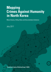 English: Mapping Crimes Against Humanity in North Korea
Korean: 북한 반인도범죄 매핑
Spanish: Trazando los Crímenes contra la Humanidad en Corea del Norte (TJWG)